

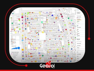
Point Of Interest
Key Data Attributes:
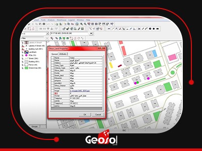
Point of interest data is structured to provide relevant information about specific locations. Here are some key data attributes commonly associated with POIs:
Location Coordinates: The geographical coordinates (latitude and longitude) precisely pinpoint the POI on the Earth's surface. These coordinates are crucial for mapping and navigation.
Name and Description: Each POI typically has a name or title, which can provide insights into its identity, purpose, or significance. A description or category may further clarify its nature.
Address: Physical addresses, including street names, numbers, postal codes, and locality details, help users locate and reach the POI. Contact Information: Phone numbers, email addresses, and website URLs facilitate communication with businesses or organizations associated with the POI.
Operating Hours: This metadata specifies when a particular location is open or accessible to the public. For businesses, it denotes the hours they're operational, while for public spaces, it might indicate the best or permissible times to visit.
Photos and Images: Visual representations, such as photos, images, or icons, offer users a preview of the POI. High-quality images can enhance user engagement.
Take your analysis beyond the address
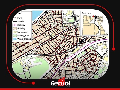
Points of Interest GIS data can help to identify places by their use and function as well as by their postal address or location. Each record also contains a telephone number, web address, and brand, where appropriate.
Identify gaps in services
For the public sector, Points of Interest lets you identify gaps in services and analyze changes in city center retail space over time. This helps you maintain a quality environment for your residents, shoppers, and visitors.
Tailor your order
You can tailor your order to just what you need - and our tiered classifications make it easy to narrow down your choices. So if you only want to know about businesses in Cairo or banks in Alex, we're here to help.