

Mobile Mapping
Mobile Mapping
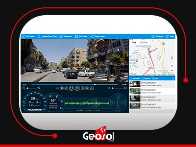
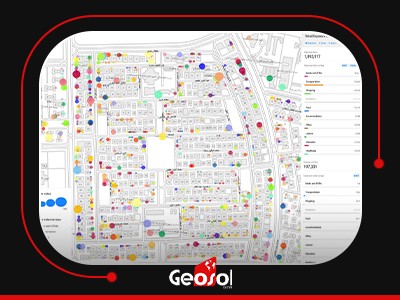
The process of collecting geospatial data by using a mobile vehicle equipped with a camera, or any photographic device. With mobile mapping systems, terabytes of high-resolution and precision data can be collected quickly. These systems can capture hundreds of measurements and POIs per second. Moreover, it can be used for monitoring street conditions and Visual distortion elements measurement used for maintenance planning. The spatial information of the target object is taken directly from the georeferenced mapping data. This may appear to be confounded, yet mobile mapping makes it unbelievably simple and hassle-free.